Cockpit feature · Pro package
Measure Areas (Satellite)
Trace property or roof areas directly on the satellite image and have them calculated automatically: no tape measure needed.
Included from: Pro package
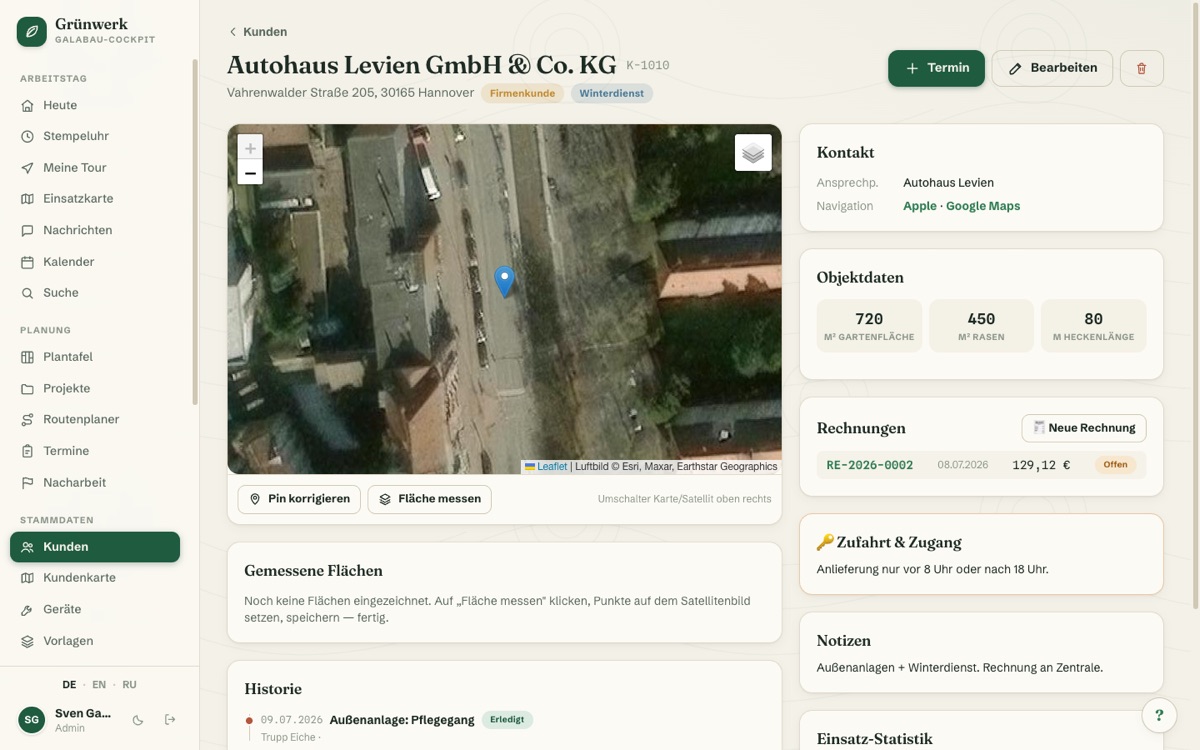
A quote needs the lawn area, paved area or roof area of the customer's property. Until now that meant measuring on site or rough guesswork. With area measurement you trace the area directly on the satellite image of the customer's address.
The app calculates the area in square metres automatically and saves it straight into the customer file, perfect for a fast quote from the office with no separate site visit just to measure.
Draw zones straight onto the aerial image
Lawn, beds, paving: trace areas on the satellite map, and the system calculates the m² automatically.
Every zone is stored permanently in the customer file.
See it live in the demo
Every property on one map
The customer map shows every customer as a pin, and clustering keeps hundreds of properties readable.
You can assess the property before the first site visit.
See it live in the demo
Faster to a solid quote
Quote without driving out: the measured area provides the basis.
Property data such as access and keys sits right next to it in the file.
See it live in the demo
What it does
- Trace the area directly on the satellite image
- Automatic m² calculation
- Saved into the customer file
- Foundation for fast quotes without a site visit
- Ideal for property, roof and paved areas
Discover more features
Included in these trade solutions
Ready-to-run trade systems built on this feature.
Try it yourself — no registration
Every trade has its own live demo with sample data. Or pick your package right away: the whole team is included.